Ophir Pass

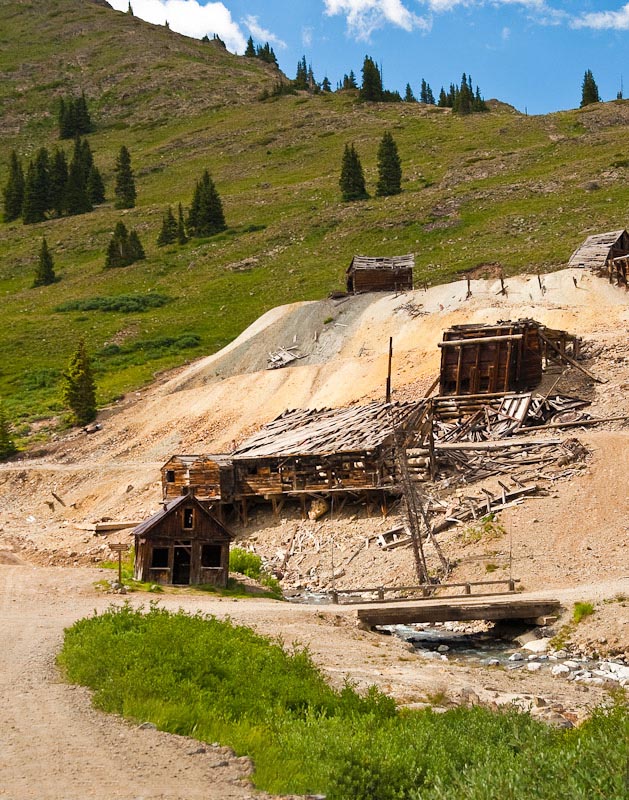
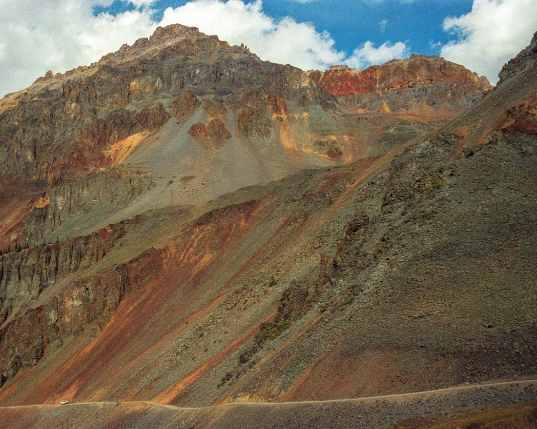
Lookout Peak towers 3,000 feet above the road.

Lookout Peak towers 3000 ft above the road!

How to get there:

From 6th St in Ouray, drive south 18 miles to CR8 to the west.

  • From Ouray to CR8
  • 18 miles 30 mins
  • GPS
  • US-550/CR 8
  • 37.8476 -107.7248

In General:4wd high clearance vehicle required

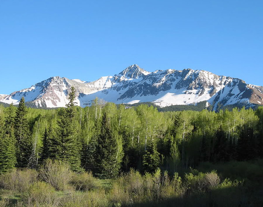
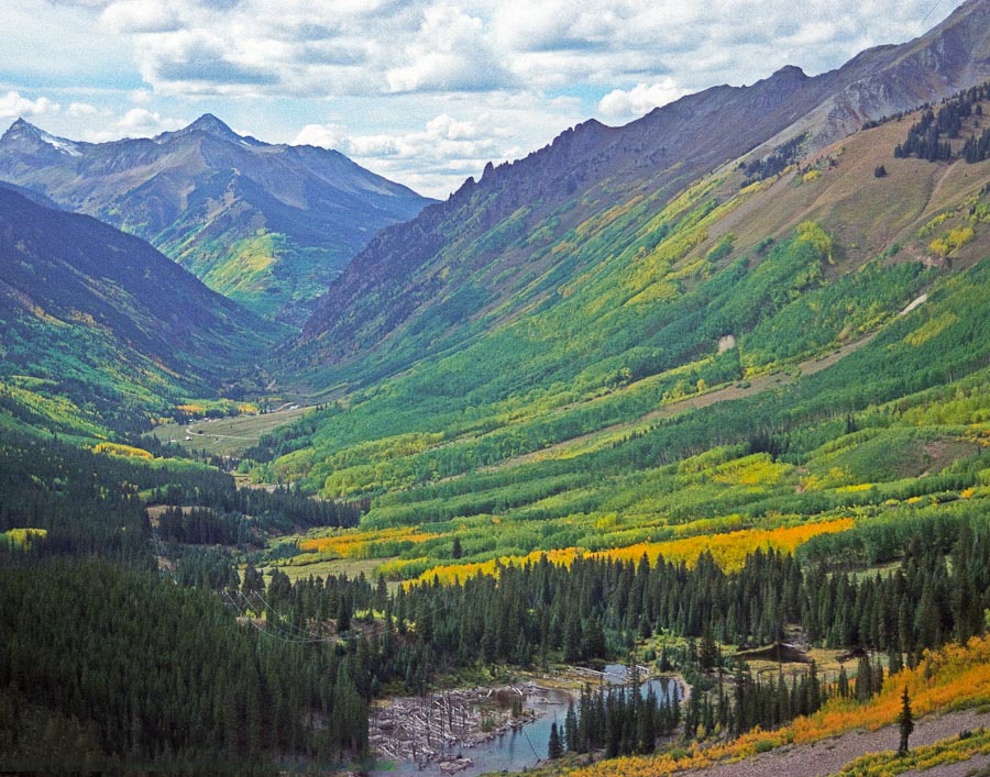
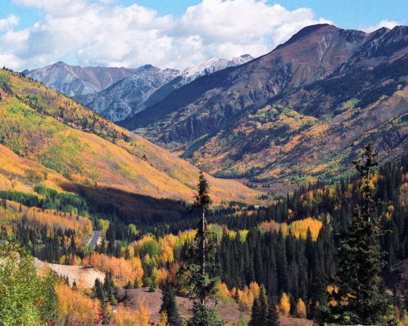
The route starts out as a wide, easy gravel road and winds through forested land in the Middle Mineral Creek area until it reaches tree line and continues to the rocky summit at 11,789 ft. The road descending into the valley is a long shelf road, narrow and very rocky in spots. It then enters a forested area before reaching the small town of Ophir and continuing on as a wide, easy gravel road to the intersection with US 145, the San Juan Skyway.

Read more

SH 145 North

From Telluride to Placerville America's BywayScenic BywayNational Forest Byway

Mt Wilson from the Silver Pick Road near Telluride, Colorado.
Mt Wilson – Silver Pick Rd

How to get there:

From Denver via US 285 to US 50 to US 550 to SH 62 to SH 145(Colo. Ave)/Aspen St in Telluride.

  • From US285/C470 to Telluride
  • 312 miles 6 hr 30 mins
  • GPS
  • SH 145/Aspen St
  • 37.9379 -107.8138

In General:CampgroundFishing AvailableKayaking Available

  • Length: 16 miles
  • Driving Time: min. 30 mins

The highway winds its way along the San Miguel River to SH62 just west of Placerville.

Read more

Bridal Veil Falls

Highest Falls in Colorado.

Bridal Veil Falls near Telluride from the Imogene Pass Road, Colorado
300Bridal Veil Falls from the Imogene Pass Rd

How to get there:

From SH 145 (Colorado Ave) and Aspen St in Telluride, drive east 3.8 miles to the parking area at the base of the Falls.

  • From Aspen St to the Falls
  • 4 miles 15 mins
  • GPS
  • Parking Area
  • 37.9202 -107.7706

In General:

Primarily pavement, the last mile is a portion of the Black Bear Pass Rd, a difficult and dangerous 4wd road, and includes a couple of steep and sharp switchbacks. Most passenger vehicles can reach the Falls, high clearance would be desirable.

Read more

Last Dollar Road

From Telluride to SH 62.

Field of sunflowers on the Last Dollar Road near Telluride, Colorado.

How to get there:

From SH145 (Colo. Ave) and Aspen St in Telluride, drive west about 3 miles and turn north towards the airport.

  • From Aspen St to Airport Rd
  • 3.2 miles 5 mins
  • GPS
  • SH145/Airport Rd
  • 37.9507 -107.8682

In General:ATVs Allowed - Check Regulations4wd high clearance vehicle requiredCampground

  • Length: 21 miles
  • Driving Time: min. 1 hrs 30 mins

Read more

SH 145 South

From Telluride to Durango America's BywayScenic BywayNational Forest Byway

Fall colors and Sunshine Mtn from Ophir Pass.
Fall colors from Ophir Pass

How to get there:

From Aspen St in Telluride, drive west 3.4 miles to the junction of SH145 S.

  • From US285/C470 to Telluride
  • 312 miles 6 hr 30 mins
  • GPS
  • SH145/SH145 S
  • 37.9505 -107.8712

In General:

The All American Road is the highest designation, given by the US DOT and was awarded to the San Juan Skyway because of the rich experience in culture, archaeology, history, scenery, and recreation the road offers to visitors. This skyway was one of the first six roads in the United States to receive this designation.

Read more

Alta Lakes | Gold King Basin

Ghost town of Alta and three lakes.

The Lizard Head formation from the Alta Lakes Road near Telluride, Colorado.
Lizard Head Mtn – Alta Lakes Rd

How to get there:

From SH 145/SH 145 S, drive 5.3 mi south to the Alta Lakes Rd and turn east.

  • From Telluride
  • 9 miles 20 mins
  • GPS
  • SH 145/FR 632
  • 37.8839 -107.8883

In General:4wd high clearance vehicle requiredCampgroundFishing Available

  • Length: 5 miles
  • Driving Time: min. 30 mins

This slightly rough, but easy 4wd road leads to the 1870s mining town of Alta (on the National Register of Historic Places) in 3.8 miles. Another 0.4 miles takes you to a spur road into the Gold King Basin and the Alta Lakes are just 0.3 miles beyond the spur.

Read more

Animas Forks to Silverton

Easy gravel route. Scenic Byway

The Gold Prince Mill in Animas Forks, Colorado.
The Gold Prince Mill in Animas Forks

How to get there:

Starts in the ghost town of Animas Forks and ends at US550 in Silverton.

  • GPS
  • Intersection at mill
  • 37.9319 -107.5711

In General:CampgroundHistorical Site or Buildings

  • Length: 13 miles
  • Driving Time: min. 40 mins

This easy gravel route is not especially scenic, but does have a lot of mining history and remnants. It does connect to some interesting side roads.

Read more

US 550

Ouray to Durango America's BywayScenic BywayNational Forest Byway

Colorful aspen on the San Juan Skyway near Ouray,Colorado.
Looking north near Red Mountain Pass

How to get there:

Starts at 6th St in Ouray and heads south to Durango.

  • From Denver to Ouray
  • 283 miles 5 hr 40 mins
  • GPS
  • US-550/6th St
  • 38.0230 -107.6714

In General:CampgroundFishing AvailableHistorical Site or BuildingsHistorical mining remnants

  • Length: 71 miles
  • Driving Time: min. 1 hr 30 mins

The Million Dollar Highway is the portion of the Skyway from Ouray over Red Mountain Pass to Silverton. The Skyway continues over Molas Pass then Coal Bank Pass and this section ends at US 160 in Durango. See the Telluride > SH 145 section to complete the loop.

Read more

Mesa Verde National Park

600 cliff dwellings. National Park

The Cliff Palace cliff dwellhttp://www.fivestarphotos.com/ing at Mesa Verde National Park.

How to get there:

The park is located in the southwest corner of the state and, from Denver, is reached via US-285 and US-160.

  • From US285/C470 to Fee Station
  • 353 miles 7 hours
  • GPS
  • Fee Station
  • 37.3317 -108.4158

In General:

Summer entrance fee is $20 per vehicle

Mesa Verde offers a spectacular look into the lives of the Ancestral Pueblo people who made it their home for over 700 years, from A.D. 600 to A.D. 1300. Today, the park protects over 4,000 known archeological sites, including 600 cliff dwellings.

Read more

Great Sand Dunes National Park

The “High Dune” is about 650 feet high. National Park

Sand dunes in the Great Sand Dunes National Park, Colorado.

How to get there:

From Denver, take the scenic route; US285 south, then SH17 south, then CR6 east from Mosca.

  • From US285/C470 to V. C.
  • 208 miles 4 hr 30 mins
  • GPS
  • Visitor Center
  • 37.7323 -105.5116

In General:CampgroundPicnic Area

Entrance fees are $25 7-day pass.

Plan to hike on the dunes in morning or evening to avoid afternoon storms, and to avoid the hot mid-day sand surface.

Read more