From Telluride to Placerville 


How to get there:
From Denver via US 285 to US 50 to US 550 to SH 62 to SH 145(Colo. Ave)/Aspen St in Telluride.
- From US285/C470 to Telluride
- 312 miles 6 hr 30 mins
- GPS
- SH 145/Aspen St
- 37.9379 -107.8138

In General:


- Length: 16 miles
- Driving Time: min. 30 mins
The highway winds its way along the San Miguel River to SH62 just west of Placerville.
Photo Ops:
Mile 3.8 east – Bridal Veil Falls 


Great photo ops!
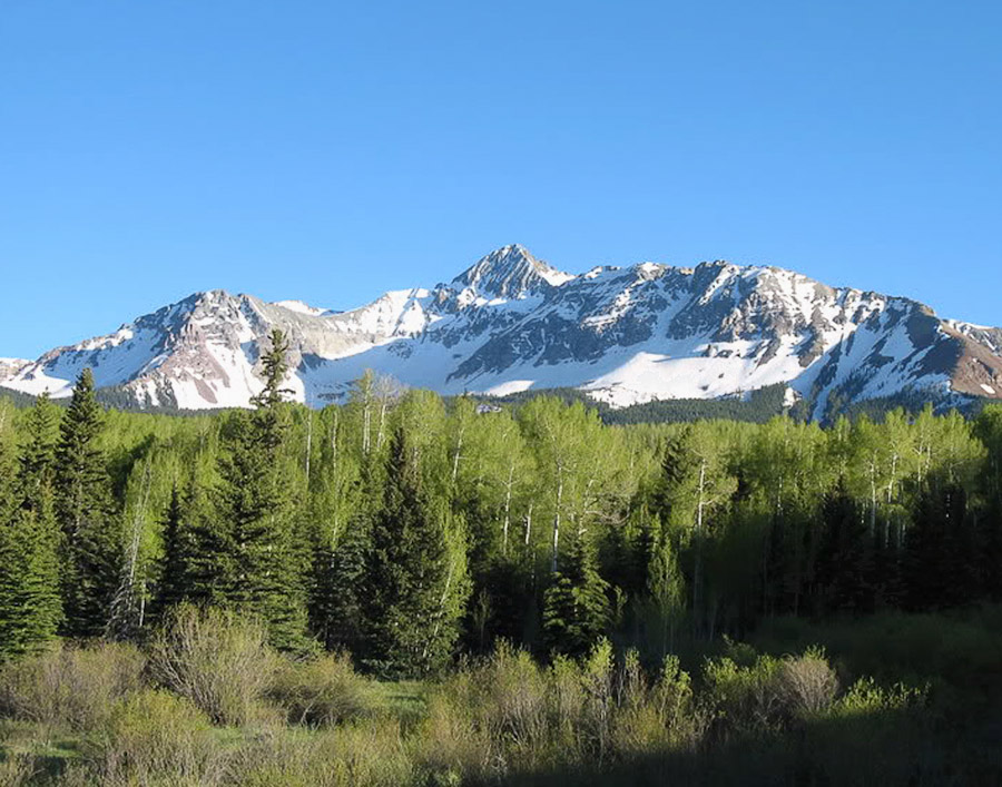
Mile 3.2 – Last Dollar Rd 


Great fall foliage and vistas of Mt Wilson and the Sneffels range.
Mile 3.4 – San Juan Skyway South
See the SH 145 South section.
Mile 9.4 – Silver Pick Rd
beehive structures that were once used in the early parts of the smelting process This relatively easy gravel road provides access to the Lizard Head Wilderness and the Rock of Ages Trail to the summit of Mt Wilson. Great fall foliage and vistas of the peaks. Kayakers often put into the San Miguel River under the bridge. Watch for photo ops of the kayakers on the river along the highway to Fall Creek Rd.
Mile 13.2 – Fall Creek Rd 

A mile west of Sawpit, this relatively easy gravel road leads to Woods Lake CG. It has 3 loops with 41 campsites, including one loop set up for horses. Popular takeout spot for kayakers on the San Miguel River.
The campground, nestled in a dense aspen forest and surrounded by dramatic mountain views, is an excellent base camp for hikers and equestrians to access the Lizard Head Wilderness via the Lone Cone Trail or Woods Lake Trail. Mountain bikers and motorcyclists can access the Wilson Mesa Trail, and fishing opportunites are within walking distance.
Mile 16.2 – SH 145/SH 62
Junction with SH 62 just west of Placerville. It’s 34 miles northeast then south to Ouray from here.