Highlights:
 Hanging Lake is unique and beautiful – Rifle Falls
 Grand Mesa
 450 ft tall Independence Monument in the Colorado NM – Natural stone arches in Rattlesnake Canyon
 Rifle Falls – Grand Mesa
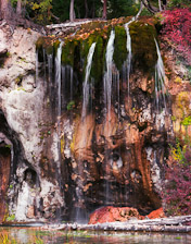
Hanging Lake
Put it on your bucket list!
How to get there:
Travel west of Eagle on I-70 to the Grizzly Creek exit (121) in Glenwood Canyon. After exiting, get back on the highway going eastbound to the Hanging Lake exit. The trail begins 1/4 mile east of the rest area on the left just before the bridge.
- From I-70/C470
- 148 miles 2 hr 30 mins
- GPS: Parking Area
- 39.5888 -107.1916

9/2021 The Forest Service has released information that Hanging Lake Trail will be closed for the rest of the peak-season and likely beyond. The announcement followed a trail assessment that found significant damage and issues resulting from debris flows during intense rain storms in late July over the Grizzly Creek burn scar.
In General: $12 Permit Required
This short, steep, scenic trail climbs up through Deadhorse Creek Canyon, gaining 936′ in elevation in 1.2 miles, to spectacular Hanging Lake.
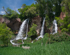
Rifle Falls
Three falls in one!
How to get there:
Take I-70 to the Rifle exit (90), then go north 14 miles.
- From I-70/C470 to the park
- 171 miles 3 hr 15 mins
- GPS
- Parking Area
- 39.6743 -107.7000
In General:

Three hiking trails provide access to the caves, the top of the falls, and the creek upstream and downstream from the park. The Bobcat Trail follows Rifle Creek to the Colorado Division of Wildlife’s Fish Hatchery. Rainbow, brown and cutthroat trout are found in East Rifle Creek, which flows through Rifle Falls. Fish up to 20 inches long have been taken, with 10- to 12- inch fish being the average size.
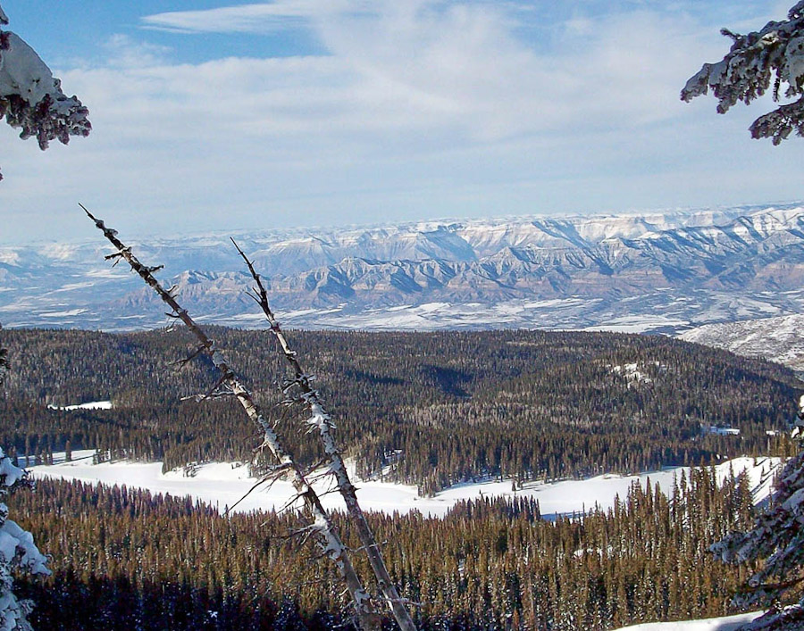
Grand Mesa
More than 300 stream-fed lakes. 


How to get there:
I-70 west to exit 49. The route begins on SH 65 and continues over the Grand Mesa to Cedaredge.
- From I-70/C470 to the VC
- 242 miles 4 hrs
- GPS
- Visitors Center
- 39.04053 -107.9877
In General:
- Length (w/Lands End):
- 72 miles Driving Time: min. 2 hours
The top of Grand Mesa ranges from 10,000 to 11,000 feet above sea level and is dotted with more than 300 stream-fed lakes and dozens of back roads and trails to explore. It’s big!
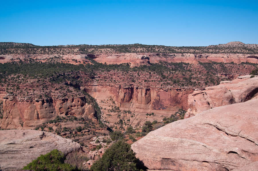
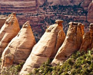
Colorado National Monument
Deep canyons and soaring cliffs. 
How to get there:
I-70 to Exit 19 (Fruita) and south on Highway 340
- From I-70/C470 to NM Ent
- 244 miles 4 hrs
- GPS
- Ent Station
- 39.1186 -108.7314
In General:
- Length: 23 miles
- Driving Time: min. 1 hour
Vehicle Entrance Fee: $20
Rimrock Drive provides access to the Saddlehorn Visitor Center and campground, 19 signed viewpoints, and 14 hiking trails — from ½ to 14 miles round trip. Many short, easy trails allow you to gaze upon or walk up to towering masses, while backcountry trails head down into remote canyons full of bird song and solitude.
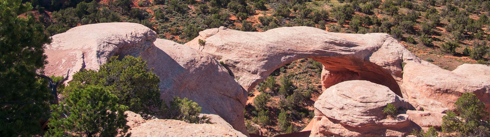
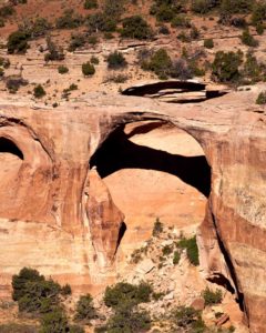
Rattlesnake Arches
A large concentration of natural arches.
How to get there:
The route is accessed from Rimrock Dr within the Colorado National Monument. Inform the attendant at the entrance station that your destination is the Black Ridge Canyons Wilderness and you will be permitted to pass through the monument at no cost.
- From I-70/C470 to Arches TH
- 265 miles 6 hrs
- GPS
- Arches TH
- 39.1370 -108.8336
In General: Seasonal Closure
- Length: 22 miles
- Driving Time: min. 1 hour
There are two roads that are seasonally opened to motorized travel. The first part of the road is shared by both roads and they intersect again near the far end.