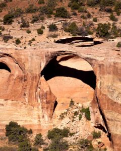
A large concentration of natural arches.
How to get there:
The route is accessed from Rimrock Dr within the Colorado National Monument. Inform the attendant at the entrance station that your destination is the Black Ridge Canyons Wilderness and you will be permitted to pass through the monument at no cost.
- From I-70/C470 to Arches TH
- 265 miles 6 hrs
- GPS
- Arches TH
- 39.1370 -108.8336

In General:
 Seasonal Closure
- Length: 22 miles
- Driving Time: min. 1 hour
There are two roads that are seasonally opened to motorized travel. The first part of the road is shared by both roads and they intersect again near the far end.
- Both roads are closed from Feb 15 – Apr 15.
- The Upper Road is open from Apr 15 – Aug 15
- The Lower Road is open from Aug 15 – Feb 15.
CAUTION: A high clearance 4X4 vehicle is required for the last 1.5 miles. Do not drive on either road when wet. Summer day time temperatures commonly exceed 90° (100° in the canyons).
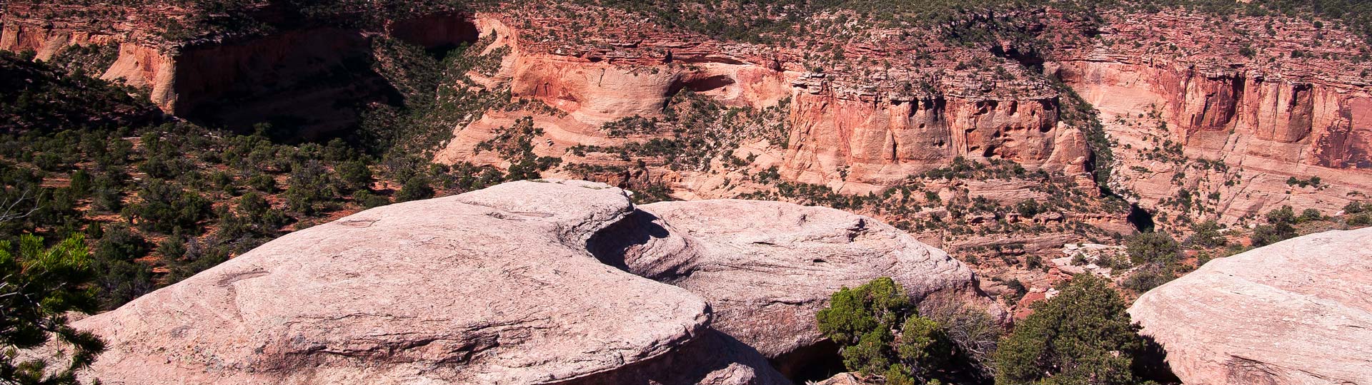
Photo Ops:

The area contains the second largest concentration of natural arches in the country, second only to Arches National Park in Utah. Rugged canyons descend to the Colorado River and contain some of the most spectacular landforms found anywhere in the country.
The arches trail is 2.2 miles one way. About a half mile down the trail you come to a sign and fork. The left fork is a half mile in length and leads to an overlook of the Rainbow Arch. The right fork leads to the bottom of the canyon then loops back to a spot below the Rainbow Arch, passing all of the major arches.