More than 300 stream-fed lakes. 


How to get there:
I-70 west to exit 49. The route begins on SH 65 and continues over the Grand Mesa to Cedaredge.
- From I-70/C470 to the VC
- 242 miles 4 hrs
- GPS
- Visitors Center
- 39.04053 -107.9877

In General:


- Length (w/Lands End):
- 72 miles Driving Time: min. 2 hours
The top of Grand Mesa ranges from 10,000 to 11,000 feet above sea level and is dotted with more than 300 stream-fed lakes and dozens of back roads and trails to explore. It’s big!
Photo Ops:


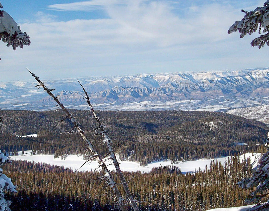
Spectacular vistas from 10 scenic overlooks; dozens of backroads and trails; meadows full of wildflowers; outstanding fall foliage; porcupines, mountain lions, coyotes, red fox, elk, and deer thrive here; there are countless opportunities for good photos in this area!
Crag Crest National Recreation Trail
10.3 mile circular trail consisting of a crest portion and a loop portion. It is accessed from two trailheads. One on the west end across from Island lake and one on the east adjacent to Eggleston Lake. The crest portion (6.5 miles) rises steeply from the East Trailhead to the top of Crag Crest. From the West Trailhead, the crest portion rises more gradually to the top of Crag Crest. Sections of the Craig Crest are on a narrow ridge with steep drop offs on both sides. The loop portion (3.4 miles) provides an alternative return route.
The view from Crag Crest extends in all directions. To the northwest, the Book and Roan Cliffs appear as multicolored cliffs and slopes. The view to the east and south includes the West Elk Mountain Range, the San Juan Range, and views of five of the 14’ers. To the west the Uncompahgre Plateau can be seen, and on the western horizon, the La Sal Mountains in western Colorado and eastern Utah is visible on a clear day.