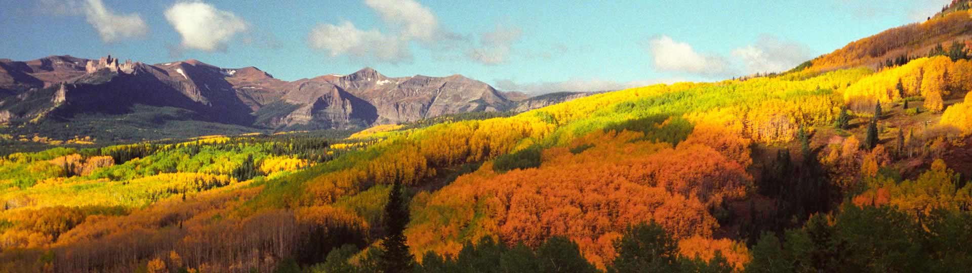
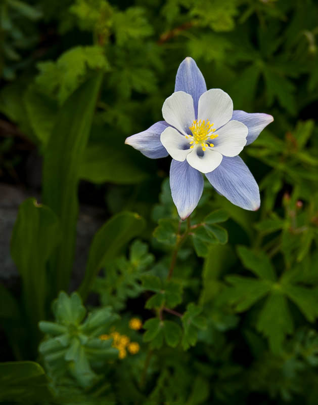
 Billed as “The Wildflower Capital of Colorado”, Crested Butte doesn’t disappoint. Try Cement Creek or the Lake Irwin area.
 Kebler Pass – Ohio Pass
 Scenery on the Slate River/Washington Gulch loop is spectacular.
Washington Gulch | Slate River
Great vistas and wildflowers!
How to get there:
The loop starts and ends at SH 135/Whiterock Ave in Crested Butte. Up the Washington Gulch Road and down Slate River Road.
- From Denver to Crested Butte
- 217 miles 4 hr 30 mins
- GPS
- SH135/Whiterock Ave
- 38.8679 -106.9808

In General:
- Length: 22 miles
- Driving Time: min. 1 hour 30 mins
Washington Gulch road starts out smooth but gets progressively rougher as it approaches the junction with the Slate River Rd, which is generally much smoother on its way back to Crested Butte.
Photo Ops:
Abundant summer wildflowers and impressive fall colors provide plenty of photo ops. There are some fine vistas a short way down from the junction offering views into the lush Slate River valley.
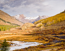
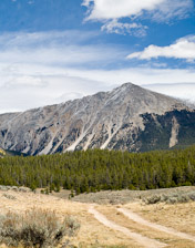
Gothic Road
Some remarkable vistas.
How to get there:
Head north on SH 135 which will become Co Rd 317/Gothic Rd. Follow the road through Gothic to Schofield Pass.
- From Denver to Crested Butte
- 217 miles 4 hr 30 mins
- GPS
- SH135/Whiterock Ave
- 38.8679 -106.9808
In General:

- Length: 14 miles
- Driving Time: min. 50 mins
This road is passable by 2wd vehicle to the pass. Return the way you came.
Kebler Pass to West Elk Loop
West Elk Loop Scenic Byway

How to get there:
From SH 135 and Whiterock Ave in Crested Butte, head west on Whiterock Ave which will become CR 12, the Kebler Pass Rd.
- From Denver to Crested Butte
- 217 miles 4 hr 30 mins
- GPS
- SH 135/Whiterock Ave
- 38.8679 -106.9808
In General:

- Length: 32 miles
- Driving Time: min. 2 hours
This generally smooth, wide gravel road connects Crested Butte with SH133 at Paonia SP and provides access to Lake Irwin/Robinson Basin and the Ohio Pass Rd.
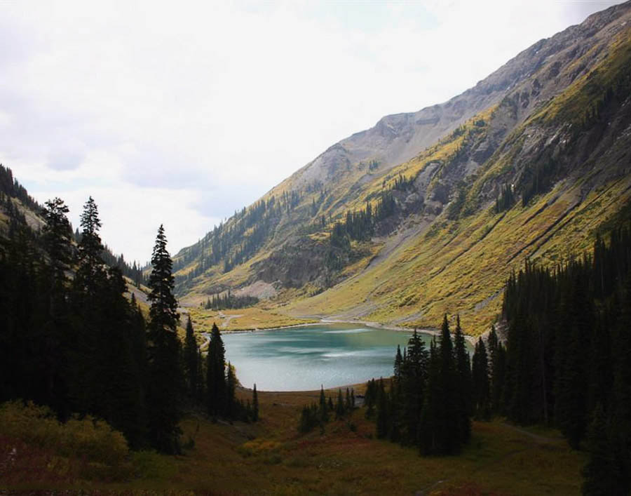
Lake Irwin
Wildflowers and waterfalls!
How to get there:
The road heads north from the Kebler Pass Rd 6.8 miles west of SH135 and ends in Robinson Basin north of Lake Irwin.
- From Denver to Crested Butte
- 217 miles 4 hr 30 mins
- GPS
- Kebler Pass Rd/CR 826
- 38.8576 -107.0951
In General:
- Length: 2.7 miles
- Driving Time: min. 15 mins
Moderately rough 4wd road. 2wd vehicles can access Lake Irwin and possibly beyond.
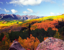
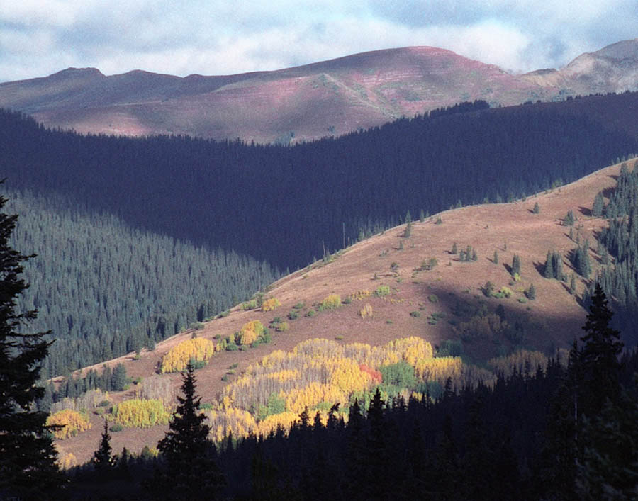
Ohio Pass Road
Awesome fall colors.
How to get there:
Starts from the Kebler Pass Rd about 7 miles west of Crested Butte and connects with SH 135 two miles north of Gunnison.
- From Denver to Crested Butte
- 217 miles 4 hr 30 mins
- GPS
- Kebler Pass Rd/CR730
- 38.8527 -107.0976
In General:
- Length: 23 miles
- Driving Time: min. 1 hour 20 mins
This road winds its way up to Ohio Pass at an elevation of 10,074′ in two miles. This first section may not be passable to 2wd vehicles depending on conditions. As you drop down from the pass, it will travel through a large aspen forest before emerging into hay meadow bottoms and cattle ranches along Ohio Creek.
Cement Creek
Great wildflower opportunities.
How to get there:
Starting from Whiterock Ave in Crested Butte, drive 6.6 miles SE on SH 135 to Cement Creek Rd on the left.
- From Denver to Crested Butte
- 217 miles 4 hr 30 mins
- GPS
- SH 135/Cement Creek Rd
- 38.8045 -106.8906
In General:
- Length: 15 miles
- Driving Time: min. 1 hour
In good conditions, the road is passable to 2wd vehicles for the first 8 or 9 miles, and then deteriorates as it approaches timberline.