The “High Dune” is about 650 feet high. 
How to get there:
From Denver, take the scenic route; US285 south, then SH17 south, then CR6 east from Mosca.
- From US285/C470 to V. C.
- 208 miles 4 hr 30 mins
- GPS
- Visitor Center
- 37.7323 -105.5116

In General:


Entrance fees are $25 7-day pass.
Plan to hike on the dunes in morning or evening to avoid afternoon storms, and to avoid the hot mid-day sand surface.
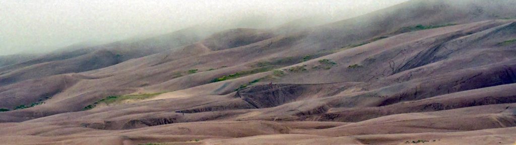
Photo Ops:


Dunes Exploration

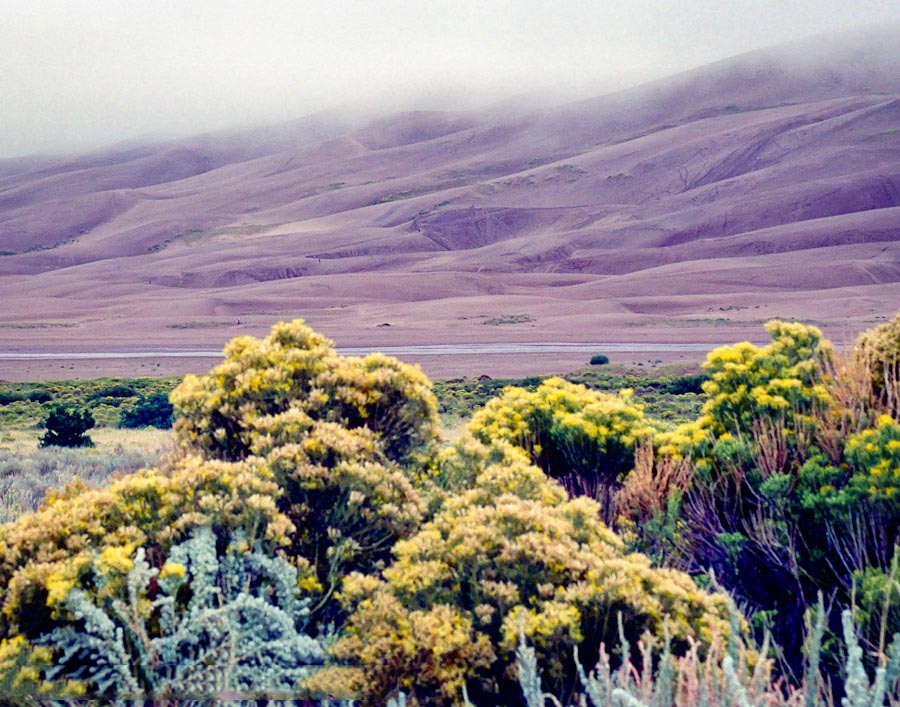
Explore any part of the 30 square mile dunefield you wish; there are no designated trails in the sand. The “High Dune” is about 650 feet high. Cross the flats and zigzag up the ridgelines to reach it. The 360 degree view is inspirational. From High Dune, the skyrising dune you see to the west is the spectacular Star Dune, rising 750 feet. It is the tallest dune in North America. To reach it from High Dune, journey another mile and a half up and down across the dunes to its summit.
Summer sledding on the dunes would create some great photo ops!
Medano Pass Road Seasonal Closure 

Driving this road requires high clearance 4-wheel drive. Small SUV’s are not recommended. The rugged road takes you through soft sand around the eastern side of the dunefield, up through a forested mountain canyon, then over 10,000′ Medano Pass, eventually joining Highway 69 in 22 miles. A scenic drive any time of the year, it is especially spectacular in fall. Creek crossings can be hazardous in spring and the road is closed when winter conditions create hazards.
Zapata Falls

Simply driving to the trailhead provides an excellent view of the entire dunefield and San Luis Valley, especially at sunrise or sunset. However, the hike to the falls requires wading over slippery rocks into a rock crevasse.
From the Visitor Center, drive south about 8 miles, then turn left (east) onto a gravel road. Drive about 3.5 miles to the trailhead. To view the falls, hike about 1/2 mile, cross the creek, then scramble up the rocks and stream into a crevasse where the 25 ft. high falls cascade onto a ledge.