Easy gravel route. 
How to get there:
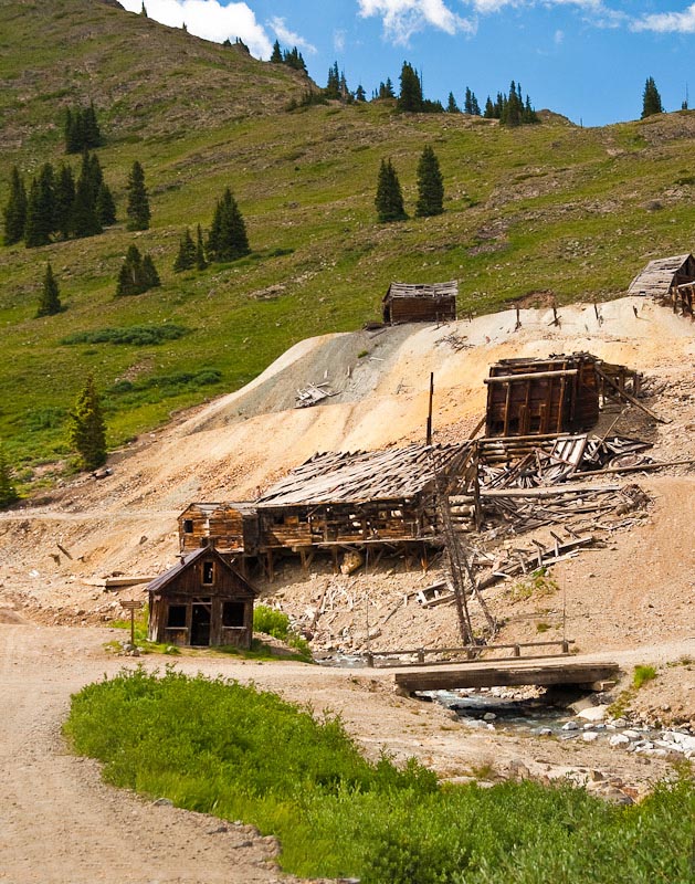
Starts in the ghost town of Animas Forks and ends at US550 in Silverton.
- GPS
- Intersection at mill
- 37.9319 -107.5711

In General:


- Length: 13 miles
- Driving Time: min. 40 mins
This easy gravel route is not especially scenic, but does have a lot of mining history and remnants. It does connect to some interesting side roads.
Photo Ops:
Mile 0 – California Pass Rd:


- Length: 4 miles
- Driving Time: min. 20 mins
This scenic road isn’t technically difficult, but it does follow a very narrow shelf road. Caution is required!
The route heads west from the bridge in Animas Forks and travels up California Gulch past the Frisco Mines, cabins, run-down buildings, and abundant summer wildflowers. It then climbs along a shelf road to the pass. If you wish, take the short hike to the summit for 360° vistas.
Mile 7.9 – Cumberland Gulch and Stony Pass Rds:
- Cumberland Gulch – Length: 4.6 miles
- Driving Time: min. 30 mins
- Stony Pass – Length: 6 miles
- Driving Time: min. 40 mins
The Cumberland Gulch route heads east up the gulch to a junction with the Stony Pass Rd at mile 1.7. From there it is 4.3 miles to Stony Pass or 2.9 miles to the end of the Cunningham Gulch road at a highpoint. Both roads offer some spectacular vistas of the surrounding countryside.
The Stony Pass road actually continues for more than 50 miles to connect with SH149 north of Creede. Because of some potentially dangerous creek crossings, I cannot recommend travel beyond the pass.