From Sedalia to Garden of the Gods.
How to get there:
- From US 85/C470 to Sedalia
- 10 miles 15 mins
From US85/SH 67 in Sedalia, drive 9.9 miles SW on SH 67 to the Rampart Range Rd.
- GPS
- SH 67/Rampart Rg Rd
- 39.3775 -105.0935

In General:

 Seasonal Closure
This generally smooth, two lane road winds its way to an elevation of 9,500 feet before ending in the Garden of the Gods. In good conditions, it shoud be passable to all passenger vehicles. ATV trails parallel most of the road.
Photo Ops:


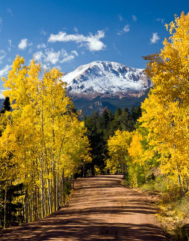
The scenery includes river meadows, rock formations, abundant summer wildflowers and impressive fall colors. Great vistas of Pikes Peak and the Colorado Springs area.
There are numerous side roads and hiking trails to explore (At your own risk!), including the Mt Herman Rd.
Devil’s Head National Recreation Trail
- Length: 3 miles RT
- Elev gain: 940 ft.
- Rating: Moderate
- Hiking Time: min. 1 1/2 hours
The trail begins by passing through several large aspen stands and continues to wind its way up through evergreen forest and around huge granite boulders. The trail ends atop a massive granite outcrop where there is a fire tower lookout, the last operating fire lookout on the front range. It can be reached by climbing the stairway up the last 200 ft. from the trail. From the tower you will have a full 360 degree view of the Rockies and the eastern plains.
Rampart Reservoir:
$7.00 day use fee. The view from the dam is breathtaking!