Moffat Tunnel – Rollins Pass Road
How to get there:
- From I-70/C470 to Black Hawk
- 26 miles 30 mins
From Black Hawk, drive 13.6 miles north to Rollinsville and turn west.
- GPS
- SH 119/Main St
- 39.9172 -105.5025

The road is rough due to lack of maintenance. Although not steep or loose, it is recommended that a high clearance 4wd vehicle be used.
Photo Ops:
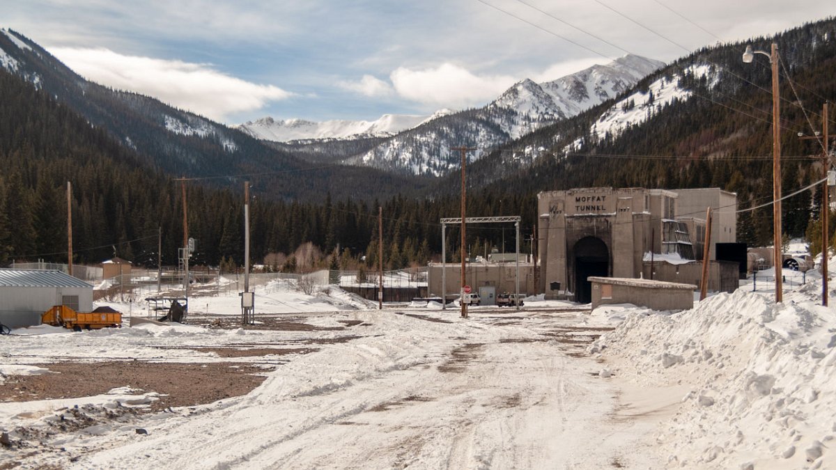
Moffat Tunnel:


The road to the tunnel parallels the very scenic South Boulder Creek. There are numerous pullouts for picnic areas and fishing. Wildflowers are abundant in the Tolland area.
Rollins Pass Road:


The first section of the road is rough and narrow in spots but has some fine vistas of the South Boulder Creek valley. After the first major turn, the road becomes somewhat smoother as it climbs through the forest towards Yankee Doodle Lake. In a good year, the wildflowers in the area around the lake can be spectacular! Look for columbines on the slopes west and above the lake. The route ends at a parking area for the Forest Lakes trail. It actually continues to a dead end at the closed Needles Eye tunnel, but because of the difficulty in turning around at that point, I do not recommend traveling beyond the trailhead.
Forest Lakes Trail:

The trail to the Upper Forest Lake is about 1/2 mile in length. The lake is a beauty. It sits in a pretty cirque below the Continental Divide with water so clear you can easily see the boulders on the bottom. There’s a small rock island just a few feet from shore that even has a tree growing on it. A cascade tumbles into the lake on the west shore, below the peaks.