Also known as Rollins Pass West
How to get there:
The Corona Pass Rd begins on the north side of US40, just west of the Winter Park ski resort.
- From I-70/C470 to CR 80
- 54 miles 1 hr
- GPS
- US 40/CR 80
- 39.8976
- -105.7695

In General:

 Seasonal Closure
- Length: 14 miles
- Driving Time: min. 1 hour
In good conditions, this road is passable by most 2wd passenger vehicles. For the most part, it follows the grade of the former Denver, Northwestern and Pacific Railway to the site of a small rail stop called Corona at the top of the pass.
The Boulder Wagon Rd is significantly more difficult than the Corona Pass Rd and will likely challenge 4wd, high clearance vehicles without lo range.
Photo Ops:


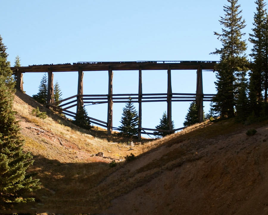
Mile 10.2 – Riflesight Notch
Here trains crossed over the trestle, went through a loop, and passed through a tunnel underneath the trestle. It makes a fine photo op today.
Mile 10.6 – Riflesight Notch Trestle
A small parking area near the end of the trestle provides a photo op of the trestle from another perspective.
Mile 12.7 – Deadman Lake/Mt Epworth
There is a fine vista to the south of the Winter Park ski resort with Deadman Lake and Mt Epworth in the foreground. To the north is Pumphouse Lake. Notice the remains of the old telegraph line along the side of the road.
Mile 13.7 – Boulder Wagon Rd 
This 1.5 mile spur leads to a small parking area. It is quite rocky and loose, and somewhat steep in spots. Lo range gearing is recommended. From the parking area, a short walk to the north to will lead you to two trestles clinging to the side of the cliff. And a short walk to the south will lead to the Needles Eye Tunnel with some nice vistas looking down on Yankee Doodle Lake along the Rollins Pass East Rd.
Mile 13.9 – Corona Pass 

(11,660 ft) The TH here offers an alternative to reaching the parking area at the end of the Boulder Wagon Rd, which can then be used to complete a loop.