The Freemont Indians lived here from ~200 BC to ~1200 AD.
How to get there:
The tour begins in the town of Rangely. Pick up a brochure and map in town to help with navigation.
- From Steamboat Springs
- 135 miles 2 hrs 35 mins
- From Meeker
- 58 miles min. 1 hour
- GPS
- SH64/White Ave
- 40.0875 -108.8039

In General:
- Length: 69 miles
- Driving Time: min. 2 hrs 30 mins
There are three sections to the tour; SH 64, SH 139, and Rangely Dragon Road (and other county roads used to connect with SH 139). Rangely Dragon Road and the other county roads are maintained, gravel-surfaced and passable, in dry conditions, by 2wd passenger vehicles. High clearance is recommended.
Photo Ops:
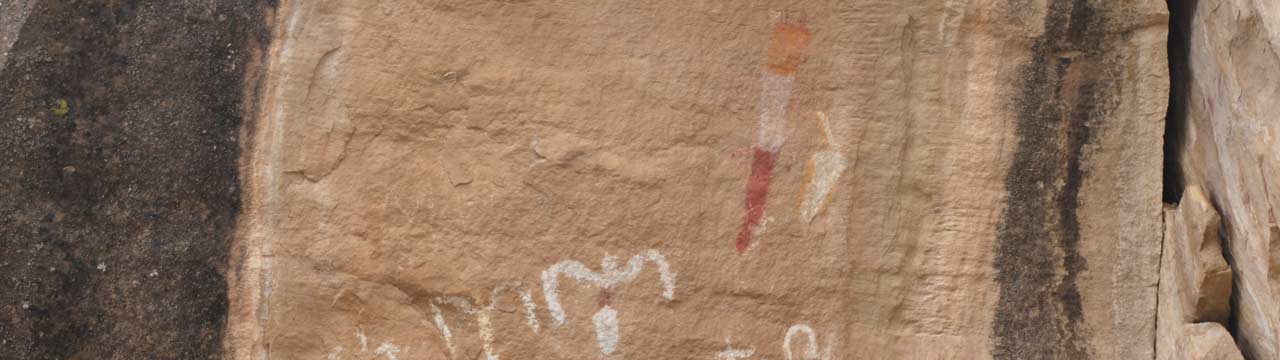
Please remember that these sites are hundreds (in some cases thousands) of years old. Time and weather have caused many to disappear, but the greatest destroyer is the vandal who defaces, chalks, chips, shoots at, and generally destroys these priceless treasures.
SH139
Mileage from SH64. Drive south on SH139
Mile 10.6 – #7 East Four mile Site
The large draw opens to the east. It has a great number of panels and a pioneer line shack. Cross the draw to reach the panels along the northern cliffs. Panels scattered along this ledge are principally Fremont. Petrified logs are embedded in the overhang and the presence of corn stalks indicate farming occurred. Pioneer cabin ruins are about 300 yards further east along the main draw and another 400 yards along the path is a stunning Fremont panel that faces in the direction you are traveling.
Mile 15.9 – #11 Canyon Pintado Site
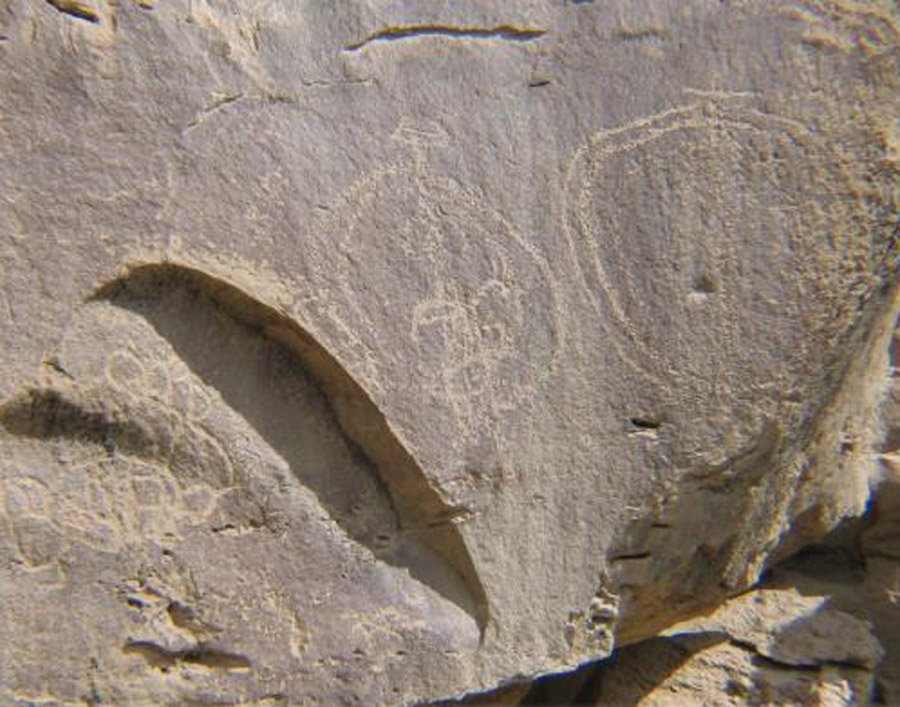
This is a principal Canyon Pintado site. The rock art adorns the cliff face just across the road. This is the site that is described in the journals of the Escalante Expedition of 1776. Of particular interest is the figure of Kokopelli, the hump-back flute player of Anasazi mythology. His presence indicates a tie with the more civilized cultures of the four corners area whose relics can be seen near Mesa Verde.
SH 64
Head west from Rangely on SH64. Mileages from Park Ave.
Mile 10.7 – #1 Mellen Hill Site
Park in the turn-out. You are on the south side of a small canyon with the Mellen Hill Caves on the north side. Walk on the ridge opposite the caves until you can see a path crossing the draw. Some agility is required to visit the three caves. Panels are generally found on the ledges at each side of cave entrances. The small overhang at the very top of the canyon and the big cave right next to it have the most art. The triangular bodied figures with the fancy headgear are Fremont but Ute art is also represented here.
Mile 11.7 – Unamed Site
On the east there is a faint dirt road leading to the bottom of the little canyon; it leads to another little cave or rock shelter that has a lovely branch antlered elk or deer figure on the rock to the left of the cave. The walk is about 50-75 feet
Mile 14.5 – Unamed Site
If the gate is open, drive west 0.9 miles. As you near the site you will see a canyon on the south side (left) of the road and the road dips to the very edge. Park here. There is a large buffalo and calf, horses, and some anthropomorphic figures at the very end on the right as you look down from the road. With a bit of care this is the place to go down into the canyon and it is maybe 50 feet to the panel.
From here you can return to Rangely of continue north to reach Dinosaur, CO in 3.4 miles and the entrance to Dinosaur Ntl Mon in another 2 miles.
Dragon Road 
Mileage from SH 64/White Ave. Head south on White Ave (will become Dragon Rd).
Mile 9.7 – #14 Fremont Ridge Site
Turn east onto the dirt road at the top of a slight hill and drive 1.3 miles to a fork. Go left 0.6 miles to the crest of a ridge and follow the signs and park off the road. Follow the trail north along the east face of the ridge for 250 yards to this eye-level panel. It is a Fremont petroglyph panel marked by soaring carrot-shaped figures.
Mile 10.1 – #15 Crooks Brand Site
Turn west, drive 0.15 miles and turn right just before the well site. Then go up toward the low cliff face ahead of you .15 miles. Here you will find incised horses with the brand of General Crook, the Ute depiction of a white man (top hat & great coat), some pin-up art left by a Basque Sheepherder, as well as an historic inscription (probable lamentation of some lost cowboys).
Mile 11.6 – #16 Carrot Man Site
This is the Moon Canyon site listed on the National Register of Historic Places. Turn west and drive 0.3 miles, pull off the road and park. Just south of the road is a small gully. Walk down the gully until you see the painted figures on the roof of the overhang. There is both pecked and painted art at this locale with soaring “carrot-men” the most stunning feature.