From Como to Breckenridge
How to get there:
US-285 south to the small town of Como. Ends in Breckenridge.
- From C470/US285 to Como
- 57 miles 1 hr 10 mins
- GPS
- US285/CR33
- 39.3104 -105.8864

In General:
- Length: 21 miles
- Driving Time: min. 1 hour 15 mins
Follows the former Denver, South Park, and Pacific Railroad route from Como to Breckenridge. In good conditions, a passenger car can travel this road without any issues.
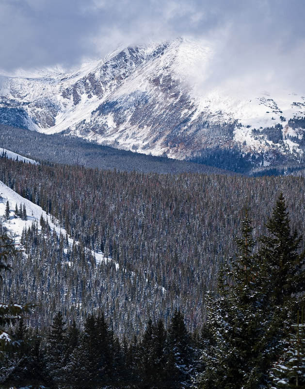
This scenic and mellow road connects Como and Breckenridge, effectively connecting SH 285 and I-70. The trail climbs to the Continental Divide and the remnants of the collection of buildings at Boreas Pass. This is also where you cross from Summit County into Park County.
The pass is preserved as a tourist attraction of sorts, with lots of helpful signs and a clean pit toilet. It also features some buildings (one of which is for rent during the cross country skiing months) and a railroad car. There is plenty of room to park and the views are gorgeous. You can see a part of South Park in the distance.
The section of road to Breckenridge from the pass is a bit rougher and less well-maintained than the section from Como. Shortly after the pass you will come across Bakers Tank. This tank served the railroad. It has been nicely preserved and you will find an informational sign on it.
Photo Ops:


On the drive down into Breckenridge, you’ll get gorgeous views of the Blue River Valley and the Tenmile Range. As with most mountain drives, wildflowers are another opportunity.